Secondary Dikes
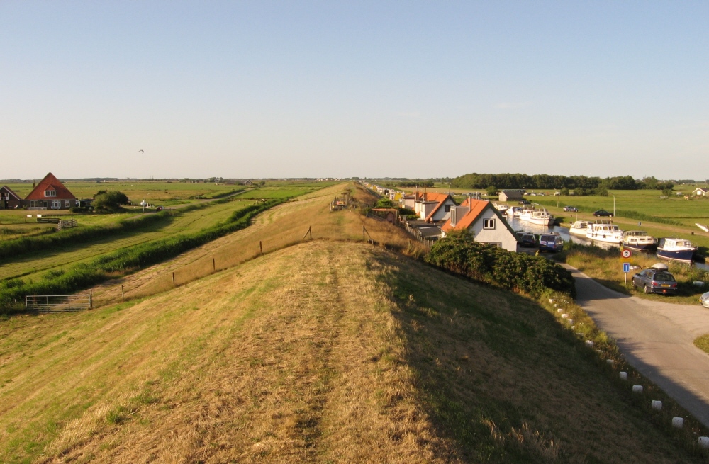
Secondary dikes work in conjunction with primary dikes to reduce the impact of a flood if the primary dike is breached.[^1] Several secondary dikes designs may be similar to that of a primary dike but on a smaller scale. For example, in the city of Winnipeg, and secondary dike is simply defined as **(any permanent dyke or other flood control work within the City of Winnipeg which has been, or is, constructed between a primary dyke and the channel)**. Hence, secondary dikes are classified based on their position and the role they play in flood mitigation. In the Netherlands, secondary dikes were historically known as ‘sleeper dikes’: a backup dike which is located between the main dike and the land.[^2] Today, secondary dikes are still a viable adaptation strategy and are usually placed behind the main dike to protect high-value residential land in the case of a breach. In between the main dike and secondary dike are the least sensitive assets such as parks and open spaces that can withstand flooding.


Types of secondary dike
- A berm is a ridge that is constructed from compacted soil. The dike could be made from composted material, gravel, crushed rock, sandbags, gravel bag barriers, or straw bales
- A temporary dike is designed to intercept and prevent runoff from entering a disturbed area It diverts or directs the water to a controlled or stabilized drainage outlet. [^7]
✓ Benefits
- Serves to intercept flood runoff and sediment from exposed disturbed areas, such as a newly-constructed road or slope, and filter sediment.
- Redirects the flood water to a slope drain, sediment basin, or other specified location.
- Intercepts runoff from undisturbed upland areas, and redirects runoff to a sediment basin or specified location. [^7]
- Limits flooding to areas that are less developed which helps to protect more developed areas.
✗ Challenges
- Must be designed and constructed to mitigate erosion caused by water diversion and concentrated runoff flow.
- For construction, topographical features such as space, degree of slope, and access can be limiting or prohibitive factors [^7]
Example projects

Citations
<! data-preserve-html-node="true"-- Regular citations -->
[^1]:
The Arlington Group Planning Architecture Inc., et al. Sea Level Rise Adaptation Primer. pp. 106. https://www2.gov.bc.ca/assets/gov/environment/climate-change/adaptation/resources/slr-primer.pdf
[^2]:
“Sleeper Dike.” Wikipedia, Wikimedia Foundation, 20 June 2019, https://en.wikipedia.org/wiki/Sleeper_dike.
[^3]:
“Dutch Dikes.” Dike Map of the Netherlands, http://dutchdikes.net/map/.
[^4]:
Ibid.
[^5]:
“Sleeper Dike.” Wikipedia, Wikimedia Foundation, 20 June 2019, https://en.wikipedia.org/wiki/Sleeper_dike.
[^6]:
City of Richmond Dike Master Plan. 6 Dec. 2016, https://www.richmond.ca/__shared/assets/_3_DikeMasterPlan_Phase246195.pdf.
[^7]:
Anonymous (nd). Best Management Practices Manual. Chapter 2 Temporary Sediment Control Management. DIKES AND BERMS. https://apps.itd.idaho.gov/Apps/env/BMP/PDF%20Files%20for%20BMP/Chapter%202/SC-1%20Dikes%20and%20Berms.pdf
<! data-preserve-html-node="true"-- Images --> [^i1]: A Typical Sleeper Dike near the Hondsbossche Zeewering. https://upload.wikimedia.org/wikipedia/commons/3/3b/SlaperdijkHondsbossche.jpg.